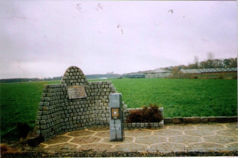
Grenspaal Ripse Paal

Boundary stone: Ripse Paal
The Ripse Paal is a boundary post mentioned as early as 1544 and inscribed on many maps starting in 1669. West of this boundary marker is …
Boundary stone: Ripse Paal
The Ripse Paal is a boundary post mentioned as early as 1544 and inscribed on many maps starting in 1669. West of this boundary marker is the Weijser Paal. In 1875 H.A. Huyskes bought about 402 ha of land at the Ripse Paal from the municipality of Helmond, which had acquired this land in 1864 at the division of the so-called Bakelse Peel. The municipality of Helmond attached the new name De Rips to it, probably because of the fact that the boundary post was the only characteristic object on the just acquired vast heathland. Hermanus Antony Huyskes had the name of the boundary post and land transferred to the new farm he had built in 1875 on the newly constructed straight dirt road from( the junction with the Hazenhutsedijk/Gemertsendijk) to the border with Oploo to the Loeff Paal. Later in 1920-21 the name De Rips passed to the parish and village.
De Ripse Paal De Rips. The boundary post to which the village owes its name.
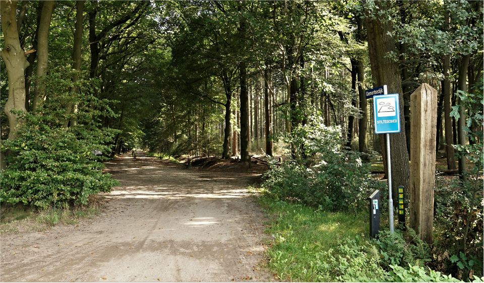
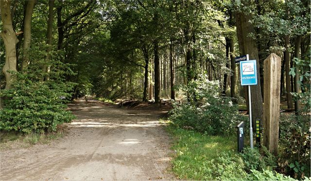
When one passes the Middenpeelweg, the name of the dirt road on which the boundary posts between Bakel and Gemert are located changes. It then changes from Langs de Palen to Grensweg. The road also does not cross a forest area but a meadow area. On the Gemert side are the properties of the former farmstead De Vossenberg, founded by the Robbé-Groskamp family in 1917. On the Bakel side of the border were successively the peel areas of Bakel, Helmond, Aarle-Rixtel and Beek en Donk, which were sold and reclaimed separately, after the mutual division in 1864. The area of Helmond, immediately beyond the current Middenpeelweg, was referred to as De Rips. The boundary post at the site traditionally had the name Ripse Paal, and the first reclamation farm was named De Rips in 1875. When in 1883 this former Helmond peel area with the first farms was offered for sale, the name De Rips was also used for it. Later the peel village De Rips was created in this area. By the way, on several old maps the name of the border post was referred to as the Kipse Paal. In all probability, this was caused by a reading error by one of the old mapmakers. Subsequently, other mapmakers adopted this reading error.
Here the Ripse Pole with the stones as the round top of the beehive. The wall is built as a section from a honeycomb. The boundary post stands between stones laid in honeycomb. All this refers to the immense moors that were once here. It provided the sheep with food and man with fuel, sweetener and many things more.
The village of De Rips
In 1864, during the division of the Bakelse Peel between the municipalities of Helmond, Beek en Donk, Aarle-Rixtel and Bakel, Helmond became the owner of a large strip of peel land near De Ripse Paal. The Helmond plot stretched from the municipal border with Gemert straight through the municipality of Bakel to the municipal border with Venraij. The current Middenpeelweg road formed just about the south-western boundary. The entire built-up area of the current church village of De Rips lay within the boundaries of this parcel. On the partition map of 1864, the only remarkable detail of this parcel is shown: the Ripse Paal!
In 1874 the municipality of Helmond sold this heathland plot of 402 hectares to Hermanus Huyskes of Hedel. In the municipal archives of Helmond is found the note that in the latter year Helmond had received the sum of 12,000 guilders, "being the proceeds of parcel De Rips. So it was the municipality of Helmond that attached the name of the boundary post to the territory that 'paled' to it. By order of Hermanus A. Huyskes, the construction of farm De Rips was started in 1875, which was put into use in 1876. Huyskes himself never lived on De Rips farm. On the reclamation, where initially sheep farming was an important part, a farm manager was appointed from the beginning. In the summer of 1883, after the death of Hermanus Huyskes, the Huyskes family offered Bouwhoeven and inculte lands under Bakel called 'De Rips', the size of 402 hectares, for sale. The sale did not go through because there was no acceptable offer. The bid was fl 3.845,-, while at the time fl 12.000,- was paid. In 1885 one Arnold Huyskes brewer in Hedel and Herman E. Huyskes merchant in Groenlo were recorded as owners. Only in 1899 they sold the company, after which it was put under the management of the Nederlandse Heidemaatschappij.
From the division of the Bakelse Peel in 1864, the name "De Rips" seems to be established. Before that it is known only as the name of a boundary post. In 1864 it passes to the parcel of heathland belonging to the municipality of Helmond, which parcel under that name is brought into cultivation by Huyskes cs. from 1874.