
Oude Handwijzer
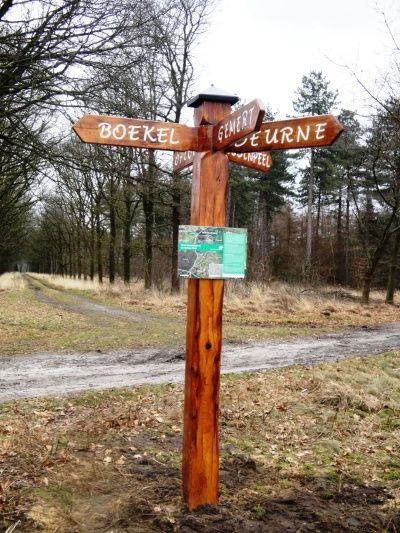
This used to be an important crossroads. Here crossed five ancient dirt roads that allowed the passage through the lonely Peel.On the topographic map of around 1850, an old hand sign was already mentioned at this place. The hand sign pointed the way to Deurne, Gemert, via the Bovenste Paal to Boekel/Gemert, and to Oploo. The fifth reference ran not to a village but to an area then called the Joodenpeel.(see map 1850) This area extended to the border of the Vredepeel in the province of Limburg. The road ended in the wet heath where it became too swampy and here, no doubt, peat was cut.
Back then there were no trees and w…
This used to be an important crossroads. Here crossed five ancient dirt roads that allowed the passage through the lonely Peel.On the topographic map of around 1850, an old hand sign was already mentioned at this place. The hand sign pointed the way to Deurne, Gemert, via the Bovenste Paal to Boekel/Gemert, and to Oploo. The fifth reference ran not to a village but to an area then called the Joodenpeel.(see map 1850) This area extended to the border of the Vredepeel in the province of Limburg. The road ended in the wet heath where it became too swampy and here, no doubt, peat was cut.
Back then there were no trees and what you saw was just an open plain and heathland. Imagine: it is foggy you are on foot or by horse and cart. How handy such a signpost on your path to show you the way. The hand sign stood there until about 1950 and now in 2011 this replica is placed near the old spot as a permanent reminder.
replica 1850. The 3 directions, Oploo, Joodenpeel and Gemert / Boekel lie after more than 150 years still in the same direction in the field. topographic map ca 1850 with two old hand signs
info panel on old hand indicator. Map from 1850 is projected over the current topofrafic map old handwijzer Aarlese Peel