

WWII: Loopgraven in de Klotterpeel | De Rips
Contact
Hazenhutsedijk
5764 RK De Rips Plan your route to WWII: Loopgraven in de Klotterpeel | De Rips

Contents
1 Trenches zigzag through the Klotterpeel
2 Background
3 Peel-Raamstelling and Koordekanaal
4 Trenches in the Klotterpeel
5 Invasion 10 May 1940
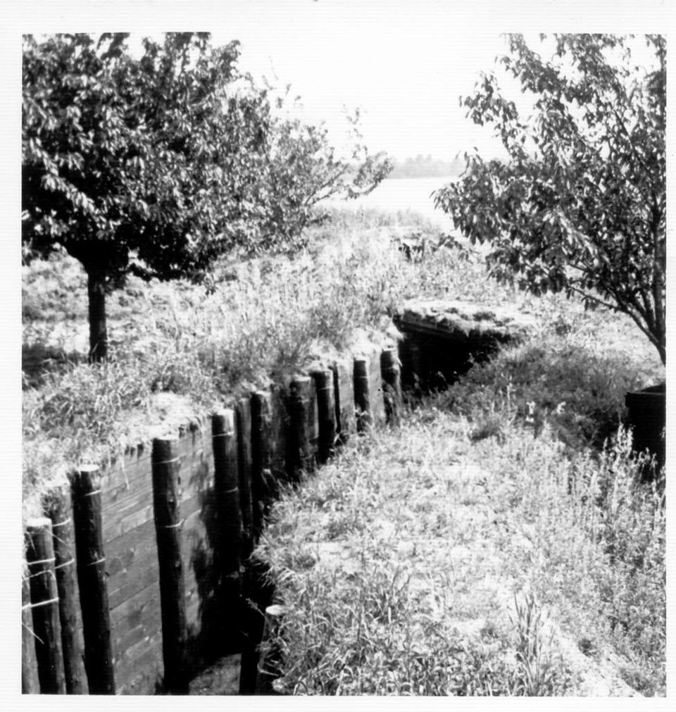
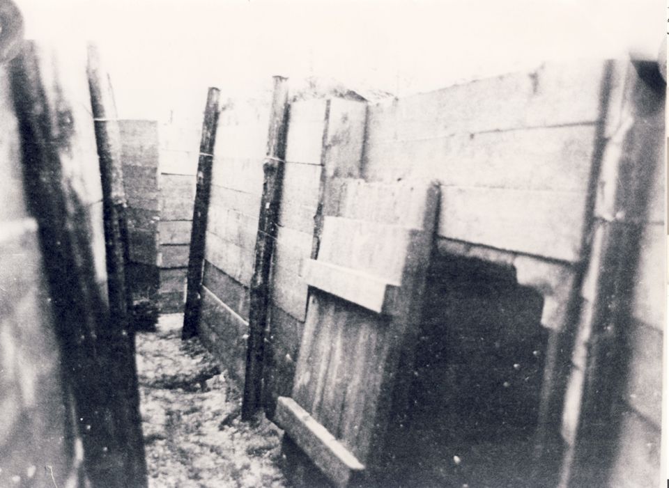
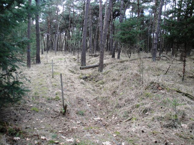
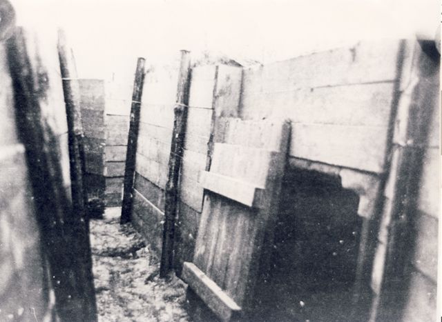
At this site lie the last remnants of the trenches that were zigzagged through the Peel just before World War II in 1939. The trenches were part of the Dutch defense against the invading enemy from the east. The trenches were equipped with wooden walls at the time as shown in the photos.
After World War I (1914-18)in the mid-1930s, Germany began to rearm again and new threats of war emerged. In the Netherlands, there was a growing realization that its defense also needed improvement. The Netherlands then formed "Cover detachments "with soldiers along the coast, major ports, traffic junctions and all borders. In the Peel, a so-called Peeldetachement was formed in 1938-39.
It was decid…
Contents
1 Trenches zigzag through the Klotterpeel
2 Background
3 Peel-Raamstelling and Koordekanaal
4 Trenches in the Klotterpeel
5 Invasion 10 May 1940
At this site lie the last remnants of the trenches that were zigzagged through the Peel just before World War II in 1939. The trenches were part of the Dutch defense against the invading enemy from the east. The trenches were equipped with wooden walls at the time as shown in the photos.
After World War I (1914-18)in the mid-1930s, Germany began to rearm again and new threats of war emerged. In the Netherlands, there was a growing realization that its defense also needed improvement. The Netherlands then formed "Cover detachments "with soldiers along the coast, major ports, traffic junctions and all borders. In the Peel, a so-called Peeldetachement was formed in 1938-39.
It was decided to establish positions along all major rivers and canals. In the south came the Peel-Raamstelling and the Defensiekanaal was dug between Mill and Griendstveen because no large water obstruction existed here yet,see map. The Defensive Canal, between the Brabant-Limburg border and Elsendorp, jumps far forward towards the east.(see map area A)This was a problem from a military point of view. Indeed, in the event of a German invasion, Area A could cut off and enclose part of the Dutch defenses.Therefore, it was decided to build a second canal that was to negate the possible adverse effects of this "bulge". A remnant of the Koordekanaal still runs through the middle of the nature reserve De Klotterpeel.
In order to still be able to defend the Koorde Canal somewhat responsibly, it was provided with field fortifications and trenches. From the trenches, the approaching enemy could be fired upon. The military constructed trenches, field fortifications, barbed wire fences and minefields on their own.The adjacent bunkers as with the Defense Canal were lacking due to financial resources.
On May 8, 1940, the German invasion was imminent. The Peel-Raamstelling was manned, but the Koordekanaal was only thinly manned by Dutch soldiers due to lack of personnel. During the Dutch withdrawal from the Peel-Raamstelling on the night of May 10-11, the Koordekanaal was also abandoned. In panic, some of the bridges over the canal were blown up prematurely. As a result, soldiers and civilian evacuees were trapped in Area A, see map, and had the greatest difficulty in escaping from Section A across the Koordekanaal in a westerly direction. However, from the fortifications, which had nevertheless been worked on for a long time, not a shot was fired in defense of our country.
Source: Rip infopanels B. Ploegmakers