Hiking the Witvenroute in Someren
From the starting point, in this part of the Keelven area, you will become acquainted with the many natural developments that have taken place here in recent years. Many hiking trails, cycling paths, mountain bike trails, bridleways and a Cooperbaan/jogging track have been built in this area to allow you as a visitor
to enjoy the diversity of this nature reserve in various ways. During the walk you cross the Provincialeweg. This road used to be the official connecting road between Eindhoven and Venlo.
You will then enter an area where a lot of forest mainten…
From the starting point, in this part of the Keelven area, you will become acquainted with the many natural developments that have taken place here in recent years. Many hiking trails, cycling paths, mountain bike trails, bridleways and a Cooperbaan/jogging track have been built in this area to allow you as a visitor
to enjoy the diversity of this nature reserve in various ways. During the walk you cross the Provincialeweg. This road used to be the official connecting road between Eindhoven and Venlo.
You will then enter an area where a lot of forest maintenance has taken place in recent years. This area is characterized by an alternation of coniferous forests and the vastness of the fens and heathland with beautiful views. Scottish Highlanders now graze in part of this area. This breed of cattle is very suitable for year-round use in nature reserves as large grazers. They require little care. Highlanders also feed on plants that many other bovine species ignore, and their long hair allows them to stay outside during the winter months.
In the northern part of the Witvenroute you will arrive at the Hoenderboompaal, a boundary post that was replaced on September 5, 1983. At the time, the five "Heerlijckheden" Heeze-Leende, Sterksel, Mierlo, Someren and Lierop were "poled" here. From this point you also have a beautiful view of the Grafven.
The walk continues via a beautiful natural bat bridge and winding paths through the pine forests. The plantings in these production forests mainly consist of Scots Pine: a tree species that grows quickly and makes few demands on the soil. Nowadays we also see other trees in this area such as Douglas fir and an undergrowth of deciduous wood that was later planted to provide more variety. We also find Oak and Birch and Willows in the lower parts. Gale we mainly encounter in places that are under water in winter and dry in summer. On the underside of the leaves are shiny, golden-yellow resin glands. They give off a strong odor. It is possible that the plant was also used against fleas because of this smell: fleabane. In some places we still see some Juniper bushes with the evergreen color and sharp needles. It is a small tree or shrub that can reach 4-5 meters in height. The sharp awl-shaped branches are in whorls of three around the branches. The common juniper is dioecious, male and female flowers do not occur on one plant and the flowering is in May. The berries take two to three years to ripen. First they are green, then blue and finally black.
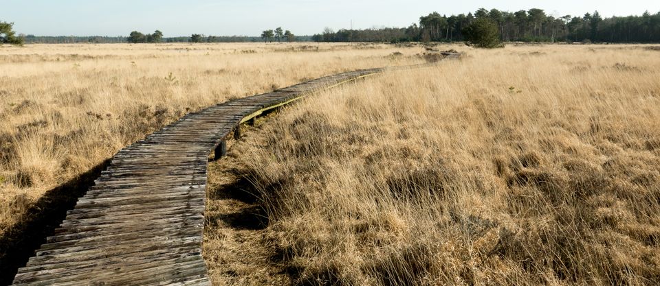
You then enter the area of De Peelrijt, a canalised, normalized river, which was used for the drainage of the Somerense Heide when this area was reclaimed around 1942. This made this water rich in nutrients. The enriched water of this river, which previously flowed into the Beuven, has damaged the special vegetation of this fen in the past. In the winter of 1985-1986 the Beuven was cleaned, which was financed by the Ministry of Agriculture and the municipality of Someren. To prevent acidification of the fen, some Peelrijt water has to be let in from time to time through a weir. The quality of the Peelrijt water has improved considerably in recent years.
Finally, you arrive at the beautiful Witven, which arose naturally. During the Ice Age, the so-called cover sand was formed here. In that period this sand was brought in by the wind and in many places in the Netherlands it is still on the surface. At a later stage, this cover sand was locally dusted, forming bowls and shifting or cover sand ridges. When the groundwater rose, these bowls filled up. The Witven originated in such an outflow. The name is probably derived from white sandven. The white sand was used in earlier days to sprinkle on the floor in "den herd".
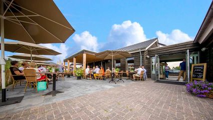
The free brochure of this WITVEN ROUTE with a route map and description of all objects is available at the Tourist Information Point, De Meer 21a Someren, or click on below
Locations on this route
Start point
Natuurpoort Vennenhorst
Bosrandweg 6
5712GX Someren
Navigate to starting point