The Laarbeek trail - Stage 2 (of 5)
General information about the 5 stages of The Laarbeekpad
The Laarbeekpad is an approximately 75-kilometre multi-day hike across the territory of the municipality of Laarbeek Waterpoort van de Peel divided into five stages. The municipality is formed by four villages: Beek en Donk, Aarle-Rixtel, Lieshout and Mariahout. The multi-day hike goes through the centre of the municipality, on and along the outskirts. In stage two, the path goes a little way over the edge to avoid a loop in the Molenheide.
In the centre of the municipality, the trail follows brook the…
General information about the 5 stages of The Laarbeekpad
The Laarbeekpad is an approximately 75-kilometre multi-day hike across the territory of the municipality of Laarbeek Waterpoort van de Peel divided into five stages. The municipality is formed by four villages: Beek en Donk, Aarle-Rixtel, Lieshout and Mariahout. The multi-day hike goes through the centre of the municipality, on and along the outskirts. In stage two, the path goes a little way over the edge to avoid a loop in the Molenheide.
In the centre of the municipality, the trail follows brook the Goorloop several times and goes through the hamlet Het Laar, among other things this brook and hamlet Het Laar between the four villages has resulted in the name Laarbeek. The municipality, on the border of the Meierij and the Peel is what the term Waterpoort van de Peel already indicates a water-rich municipality with, within the municipality, the canals Zuid-Willemsvaart with a marina and the Wilhelmina Canal. Not only the canals but also brooks the Aa and the aforementioned Goorloop but also smaller streams such as the Schevelingse Loop, Heieindse Loop, the Ginderdoorse Loop and the Donkervoortse Loop flow through the municipality, furthermore water features and fens complete the term Waterpoort. So Laarbeek is a real water municipality. During the multi-day hike, one therefore passes bridges and small bridges several times. The term gateway to the Peel is derived from the fact that the municipality lies on the edge of the Peel.
The trail is divided into five stages with the starting and finishing points being the core of the towns with Beek en Donk being a twin village like Aarle-Rixtel with the difference that Beek en Donk has two cores, each with its own church building. A twin village is the designation of two villages originating close to each other with different names. The first stage starts in the core of Beek and the last the fifth stage starts on the Donk and then ends in the core of Beek. The core of Beek and the core of Donk are separated by a green strip containing a music garden. Since 2003, the new town hall of the municipality of Laarbeek, which was newly formed in 1997, has stood in this strip.
PLEASE NOTE:
A large part of this hike is unpaved!
This route is not suitable for wheelchairs or prams.
Dogs are not allowed.
Courtesy of: klikprintenwandel.nl
Sights on this route
Starting point
Startpunt
Dorpsstraat 5
5735 EA Aarle-Rixtel
Navigate to starting point
Church Onze Lieve Vrouw Presentatie Aarle-Rixtel
Dorpstraat 55735EA Aarle-Rixtel
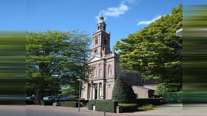
Church Onze Lieve Vrouw Presentatie Aarle-Rixtel
Church Onze Lieve Vrouw Presentatie Aarle-Rixtel
Dorpstraat 5
5735EA Aarle-Rixtel
Chapel Onze Lieve Vrouw in ‘t Zand Aarle-Rixtel
Bosscheweg 185735 GV Aarle-Rixtel
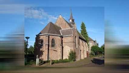
Chapel Onze Lieve Vrouw in ‘t Zand Aarle-Rixtel
Chapel Onze Lieve Vrouw in ‘t Zand Aarle-Rixtel
Bosscheweg 18
5735 GV Aarle-Rixtel
End point
Eindpunt
Heuvel
5737 Lieshout
Navigate to endpoint
Directions
Route description
Note: Please note: A grazing area with sheep and estate “Groot Overbrugge” are not accessible with a dog, the route description includes an alternative that goes around the grazing area and around the estate.
Reference is made to route posts at various points. The entries are intended only as additional landmarks.
1.
Leaving RA with your back to the church, follow the road to a road on the left before a park with kiosk, ignore road on the right.
At this road LA, road with the park on the right, then past house no.5 LA, enter narrow alley with a café on the right, a little further through a wooden pedestrian lock.
Before back of houses RA, also a narrow alley.
At end of alley, at T-junction RA, paved road, immediately afterwards LA ‘Kapellaan’.
For entrance to a care centre, at T-junction RA, kn32 follow 52, follow the road to a crossroads.
# With chapel Onze Lieve Vrouw in 't Zand on your left, this chapel was built at the end of the 16th century and has traditionally been a place of pilgrimage.
At this junction LA, ‘Janssensstraat’, wn route.
In a slight bend to the right of the road LA ‘Valkendijk’, wn route, follow the road to the 2nd road on the right, ignore other side roads.
At this road RA, ‘Buizerdstraat’, wn route, road with a BMX terreintje on the left.
2.
In bend to the right of the road keep left, paved footpath with a wooden footbridge, wn route.
# Further on, the walk goes through a sheep grazing area and through the Overbrugge estate, dogs are not allowed there. Alternatively: At the end of the footpath, at the crossroads, turn right and follow the road to a bend in the road. In this bend RD, wide unpaved path. At T-junction RA, path with a metal barrier a little further on. At the end of the path, at T-junction LA, follow the paved road until path on the right before a stream in a slight bend to the left of the road. Continue at point 4 penultimate line.
At the end of the footpath, at crossroads RD, paved road, ‘Laag Strijp 20-22-24’, wn route, after approx. 70m the road changes into a paved footpath, follow the footpath until you reach a gate on the left.
At the swing gate LA through the swing gate, wn route, semi-paved path through grassland with a 2nd swing gate further on.
3.
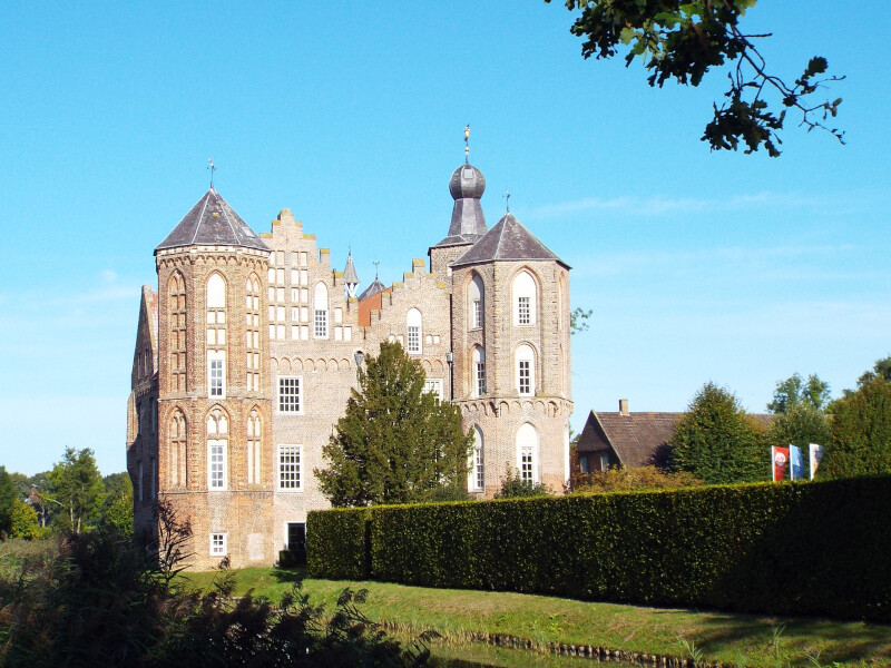
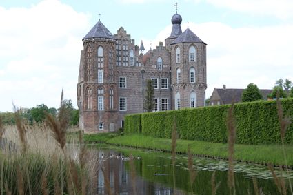
At 3-junction with a bench on the right keep left, wn route, further on through a swing gate and follow the path further to a junction before the gate to Croy castle.
# If the gate is open, you can also follow the avenue RD to a dirt path past the forest parcel on the left. At this path LA, path between moat and forest plot, further between posts in a beech hedge and through a ditch. Past the ditch RD, enter the road on the right of the small park, kn53 follow 69, follow the road ‘Kasteelweg’ to a path on the left at ‘Martien Hoeve’ no.4. Continue at point 3 last line.
# The oldest parts of Croy Castle probably date from the mid-fifteenth century. In 1472, one Rutger van Erp owned a castle with farmstead here. In 1477, he sold the castle to Jacob van Croy, the namesake of the castle. Later, several noble families occupied and expanded the castle.
At this junction LA, paved road, kn52 follow 53, a little further at 3-spot keep right, ‘Croylaan’, wn route.
At junction keep left, kn53 volg 69 (at the junction slightly further along the road on the right), a little further at Y-junction also keep left, ‘Kasteelweg’, follow the road until a dirt road on the left hand side near ‘Martien Hoeve’ no. 4.
At this path LA, dead-end unpaved path with a metal barrier further on.
4.
About 140m past the barrier RD, ignore wide path on the left, then after about 50m RA, narrow path with BL sign ‘Croy’ and a hedge on the right and a fence on the left.
At the end of the path at T-junction LA, then after approx. 40 RA walk via a small dam in a watercourse to a lower path on the other side of the watercourse, immediately afterwards at 3-junction with sign ‘Opengesteld’ RA, the path bends to the left.
Before a forest parcel, at T-junction RA, the path bends to the left, then past a bend to the right RD, ignore path with sign ‘Opengesteld’ towards a stall on the left.
At T-junction LA, follow the paved road to a path on the right before a stream in a slight bend to the left of the road.
At this path turn sharp RA, unpaved path with the stream on the left, kn69 follow 30 (stands slightly further to the left of the road).
At 3 junction with concrete bridge on left keep right, wn route, follow the path with stream Goorloop on left hand side to a junction with a hardened road.
5.
At this junction RA, paved road, kn30 follow 54.
Before a moat on the left hand side LA through a wooden gate with a small gate, unpaved path, kn54 follow 59
After approx. 170m, just before a wooden barrier LA, wn route, follow the path to a junction with a hardened road well past a wooden gate with a small gate.
At this T-junction LA, paved road, the wn route is abandoned.
Past stream the ‘Goorloop’ RA, grass/maintenance path with the stream on your right.
# At high water level of the Goorloop or if the grass/maintenance path is difficult to walk on due to overgrowth, turn around and follow the path back, follow the road to the T-junction. At this T-junction LA, immediately afterwards in bend to the right of the road RD, wide gravel path, ‘Croylaan nr 4-1-2’, follow the gravel path to junction with the stream. Continue at next line starting at: then after approx. 30m LA......... .
Just past a pond and a bench on the left, at the end of the path, at T-junction LA, gravel path, then after approx. 30m LA towards the forest, before the forest the path bends left, just past a bend to the right the path follows the forest edge on the right.
After approx. 220m RD, ignore well-marked path through the forest on the right.
After approx. 130m RA, also a well-marked path through the forest.
At T-junction LA, follow the wide path approx 270m to a junction with a narrow path and to the right a wooden pedestrian lock with sign ‘Opened’, ignore narrow side paths.
6.
At this junction RA, after about 90m the path bends left.
At end of path, at T-junction LA, wide path with separate paved cycle path.
At crossroads RA, wide straight path, wn route.
After approx. 350m RA, path with 6 posts and sign ‘Opengesteld’, wn route.
At T-junction LA, wn route, slightly further follow the path with a slight bend to the left, ignore path on right hand side, wn route, follow the path further until a junction past Gasunie pole ‘A521’, well before this junction the wn route is left, ignore side paths.
At this crossing RA, follow the path to a crossing, ignore narrow side paths.
At this crossing RA, follow the path to a 5-spot (the narrow path over a small hill on the right is included) approx. 50m past a clearing with a fen (is often dry) on the left.
At this 5-junction LA, wn route, after approx. 80m the path bends left around the clearing that can be seen between the trees on the left, follow the path further to a path on the right just before a crossing, ignore other side paths.
7.
At this path RA, wn route, the path runs parallel to the path on the left, after approx. 60m the path bends to the right away from the path on the left.
At junction with a narrow path RD, wn route.
Just before leaving the forest, keep right past wooden posts, the wn route is abandoned, a little further also keep right, follow the path with forest edge on the right until a 5-spot at a hardened road past an agricultural parcel on the right, ignore side paths.
At this 5-spot enter the 2nd path on the right, the narrow gravel path with a row of wooden posts and a fence, wn route.
Past a bench, at 4-spot RD, ‘Heicamp’, wn route, enter the path on the opposite side of the paved cycle path and wide path.
Before a bench, at 4-spot LA, wn route, follow the wide path to a junction past house no.2, ignore side path.
8.
At this crossing LA, ‘'t Brierke’, the wn route is abandoned, then at crossing with a main road RD, unpaved path.
At the end of the path, keep left at the Y-junction, hardened road, then follow the road with a curve to the left, ignore the cycle path on the right.
At junction with a main road, cross the bridge RA, follow the cycle path on the other side of the main road, then past a row of posts to the left of the cycle path, descend the embankment LA, unpaved path, down at T-junction RA, paved cycle path with the Wilhelmina canal on your left.
Past the Bavaria factory site, at 3-junction RA.
At crossroads RD, follow the cycle/footpath with a parking area on your right, then at the end of the path RD, ‘Havenweg’, ignore the road on your left.
At Y-junction RA, follow the road to a small square with a kiosk, the end point. To bus stop Bavaria, follow the road Ribbiusstraat with the church on the right a bit further until a T-junction at a through road. At this T-junction RA, through road Provinciale Weg towards a roundabout, before the roundabout is bus stop Bavaria on the left, the end point.
Legend:
RA = turn right, RD = straight on and LA = turn left
BL = Brabants Landschap
Walking networks:
Green/yellow markings, kn stands for a junction post with numbered direction, wn stands for a network route post with direction only.
You may also be interested in
-
Through 't Gulden Land
Through 't Gulden Land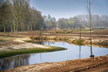
A tour of the head of the place where greenery, water, cultural history and recreation go hand in...
(7.3 km) -
Head of ‘t Gulden Land
Head of ‘t Gulden Land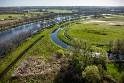
A short walk through the place where greenery, water, cultural history and recreation go hand in...
(2.7 km) -
Discover ‘t Gulden Land
Discover ‘t Gulden Land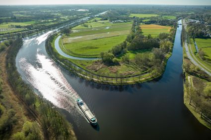
Discover the place where greenery, water, cultural history and recreation go hand in hand.
(9.9 km) -
The Laarbeek trail - Stage 5 (of 5)
The Laarbeek trail - Stage 5 (of 5)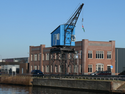
The fifth stage (17 km) of the Laarbeekpad, a long multi-day hike across the territory of the mun...
(17.0 km) -
The Laarbeek trail - Stage 1 (of 5)
The Laarbeek trail - Stage 1 (of 5)
The first stage (15 km) of the Laarbeekpad, a long multi-day hike across the territory of the mun...
(15.0 km) -
The Laarbeek trail - Stage 3 (of 5)
The Laarbeek trail - Stage 3 (of 5)
The third stage (16 km) of the Laarbeekpad, a long multi-day hike across the territory of the mun...
(16.0 km) -
The Laarbeek trail - Stage 4 (of 5)
The Laarbeek trail - Stage 4 (of 5)
The fourth stage (15 km) of the Laarbeekpad, a long multi-day hike across the territory of the mu...
(13.0 km) -
Monastery walk Aarle-Rixtel
Monastery walk Aarle-Rixtel
This monastery tour lets you discover the beautiful nature around the Missionary Convent Holy Blo...
3 hour 20 minutes (13.0 km) -
Rand van De Peel
Rand van De Peel
On the edge of the Peel, you can relax during this route. A varied landscape will continue to sti...
(26.1 km) -
Recht en Orde Laarbeek
Recht en Orde Laarbeek
Cultural-historical walking route between jaw and gallows.
(19.0 km)