Nature in Laarbeek
Waterpoort van de Peel

The greenest municipality in Europe!
Laarbeek is a leader in the field of green and sustainability and the way inhabitants are involved in this. This became apparent in September 2016 during the National Green Competition. The professional jury awarded the highest score ever (8.6) and a special prize for biodiversity. In 2017, international recognition with the European Gold Award was added. But the most tangible 'golden' project is surely the GroenStrijd 2.0: a joint initiative in which residents, together with local green entrepreneurs, set to work on greening their living environment. Caring for one's own environment and the will to cooperate are anchored in the DNA of the inhabitants of Laarbeek. Social cohesion within the municipality has increased. And with that, Laarbeek has also won the Steenbreek Trophy 2018!
Croy country estate
The Croy estate is a beautiful green area around Croy Castle that covers no less than 254 hectares. A number of interesting companies can be found on and around this estate. The lay-out consists of a well-preserved infrastructure of medieval origin, formed by a double rectangular moat surrounded by a ring of trees. Meadows lie between the inner and outer moat; the inner moat on the north and west sides was filled in during the 20th century. Originally, the castle was accessed from the east by the gatehouse, but in about 1790 the driveway was shifted northwards to create an axis. This avenue, which is projected perpendicular to the entrance in the north façade, is flanked by old oak woods; in the woods, a pathway lined with Douglas fir trees; the east side is closed off by a beech hedge. The castle island is laid out with a partially enclosed rectangular kitchen garden to the east of the castle; forecourt with cobblestone pavement; in front of the farm, a row of lime trees. A well-preserved relationship between the estate and its surroundings with farmland, groves and oak tree-lined avenues.
More about.............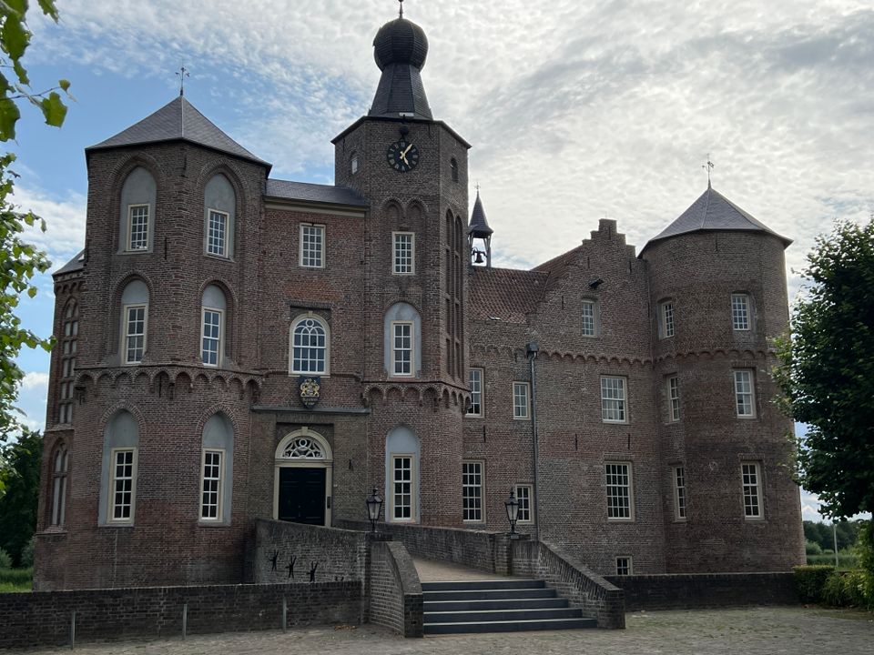
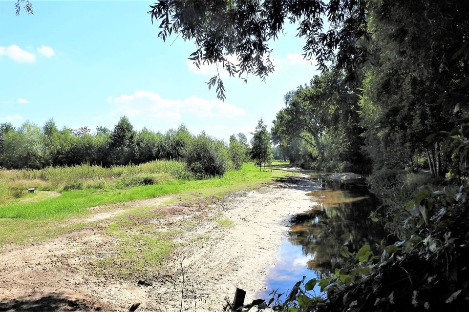
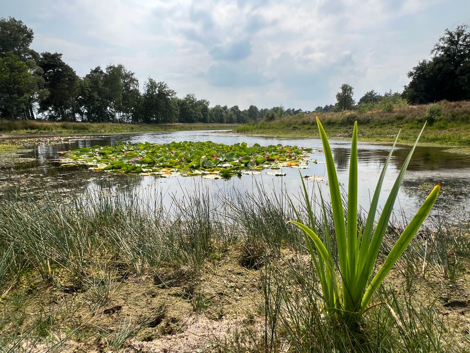
Nature reserve De Biezen
All kinds of developments have taken place in this fascinating nature reserve in recent years. Weirs have been built, culverts raised and ditches filled in. By leaving dead wood lying around, an attempt is made to create a rich insect world. Poplars have been planted, as well as dry oak woods and marshy woodland. The poplar planting is being transformed into an area with ash and alder. There are also meagre and flowery grasslands. The nature reserve is inhospitable and damp. You can take an adventurous walk here, also going off the beaten track.
More about.............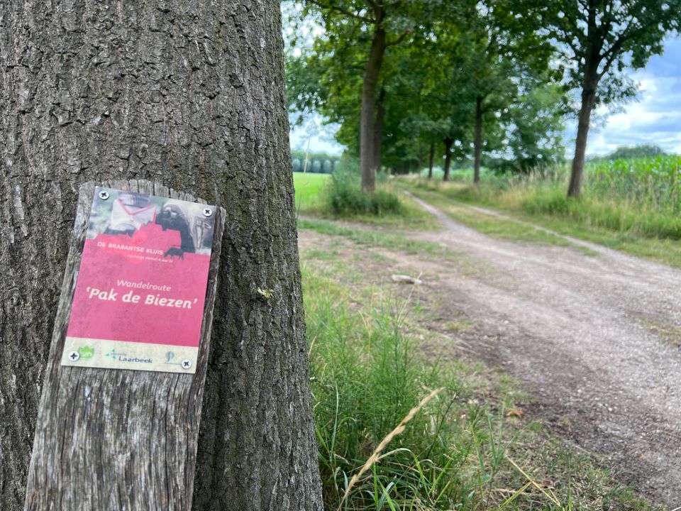
De Groene Long
Water features, unusual trees, bridges and benches can be found throughout the Green Long. Everywhere there are signs to make you aware of nature. The tour is - in dry times - accessible for wheelchairs. In wet times, it is possible for buggies or prams. Through the Green Lung, you can also have fun watching birds. A bird nature trail has been created here. Apart from birds, you can also enjoy the beautiful trees and plants. And of course of the fascinating insect world.
More about.............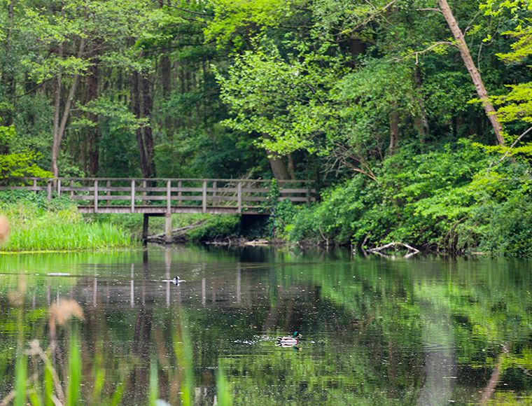
Mariahoutse Vennen
The Mariahoutse Bossen, also called Lieshoutse Bossen or Lieshoutse Heide, is an elongated Dutch forest area of 158 ha, located immediately to the north of Mariahout. The forest, which is owned by the municipality of Laarbeek, is a young heathland forest and consists mainly of plantations of Scots pine, although other tree species, such as beech, can also be found. In the south-west of the area is the Torreven (sometimes also called Torrenven or Torenven). This is an elongated fen that threatened to become silted up and was cleaned up in 1992. The area, which is surrounded by heathland remnants, is now managed in such a way that the edge of the forest is pushed back, which prevents land accretion because the wind has more room to play on the water surface. Parts of it are also being flattened and the area is being grazed by sheep. South of the Mariahoutse Bossen is the Heieindse Loop. The area connects to the Vresselse Bos in the west, to the woods of Olen and Mosbulten in the southwest, and to the woods of Lijnt and Het Geregt in the east. To the north of the area, there is an extensive agricultural reclamation. In the south-east, a small marshy area, the Rietven, connects to the Mariahoutse Bossen. Today, this is an area of birches and oaks.
More about.............
De Blauwe Poort
Water storage Blauwe Poort in Beek en Donk. In the countryside between Beek en Donk and Boerdonk lies the Blauwe Poort, an innovative water storage area. It looks like a painting. In the middle of the green area along the N279, opposite the Bemmer industrial estate, a real gate has recently been erected that leads to the stairs of the newly installed watchtower where visitors can oversee the entire area. The water storage area is designed in such a way that flowery grassland can develop well and meadow birds and the 'big mud creeper' (a protected species of fish) can feel at home. From the Blauwe Poort, you can spot the meadow birds.
More about.............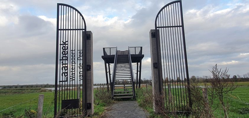
Eyckenlust Castle
The castle is located on the Aa. The paths on the 61 ha estate are freely accessible, only the immediate vicinity of the castle is not. The estate consists partly of forest (mainly poplars) and some farms. The core of the estate is formed by the spaciously enclosed pentagonal castle island, accessible via the gatehouse; between the gate and the main building a short lane is planted with ca. 200 year-old lime trees ending in a forecourt. From the Gemertseweg, a second entrance lane ran parallel to the irregularly flowing River Aa; parts of this lane have been preserved. Due to the normalisation of the Aa (1941) both avenues no longer connect. To the southeast of the (main) entrance road lies a remnant of the original kitchen garden and orchard, of which only a row of pollarded pear trees parallel to the driveway is a reminder (otherwise meadow). In the immediate vicinity of the house are a few solitary trees (walnut, brown beech, swamp cypress, plane tree). To the north of the house is an orchard with mainly half-standard pear trees.
More about.............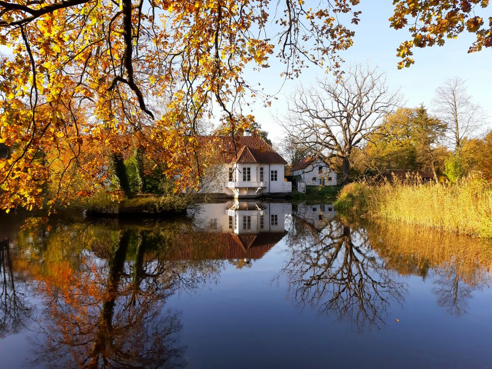
Ruweeuwsels
In the Middle Ages, the Ruweeuwsels formed the south-western boundary of the Lieshout estate. The term 'eeuwsel' was generally understood to mean a low-lying, somewhat swampy area covered with brushwood, thorny bushes and, in places, poor-quality grass. In 1760, the Ruweeuwsels were made suitable for forestry. For this purpose, the whole area was levelled, after which ditches were dug and rows of trees were planted in between. The current Ruweeuwsels therefore date back to 1760 and are not an original piece of Brabant nature, as is sometimes assumed. In 1918, the municipality of Lieshout purchased a few more neighbouring plots, which gave the Ruweeuwsels their current size. Timber production was continued by the various owners until 1968 when the Ruweeuwsels came into the possession of the Stichting het Brabants Landschap and the emphasis shifted entirely to the landscape value of the Ruweeuwsels.
More about.............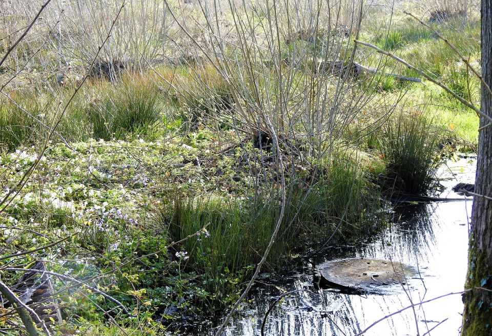
Nature garden De Bimd
Behind and around the IVN building at Beekseweg 3 in Aarle-Rixtel, there has been a nature garden since the end of 1980. A garden full of nature, adventure and places to discover! Over the years, this garden has been expanded to a total area of approximately 5000 m², of which approximately 2500 m² is freely accessible. The closed section consists of a pond with a wetland situation, a wooded bank with, among other things, stinzenplants, plant borders, pollard willows, an insect wall, a herb circle, bird breeding bushes, a barefoot path, small berry boxes, a terrace and, in the development, a butterfly meadow with a food forest. The open section consists of an old poplar forest with an insect wall, a pond, a beehive, pollard willows, a butterfly garden, a Tiny Forest, an orchard with old fruit varieties and much more. Furthermore, a nature trail has been created as part of the "De Aarlese Beemden" walk, where several ponds can also be visited.
The goal is to showcase the biodiversity of as many Dutch wild plants, shrubs, and trees in the garden as possible. Most of these plants are marked with signs indicating their species. Guided tours with an experienced guide are available upon request.