Hiking the Vlerkenroute in Someren
This signposted walking route starts at the De Vloeten car park along the road from Someren to Lierop. You can also start at Camping
Somerense Vennen on the Philipsbosweg. Follow the Vlerkenroute signs. The free brochure of this Vlerken walking route with a map and description of all objects is available at the Tourist Information Point, De Meer 21a Someren, or click the button below; "View route in PDF".
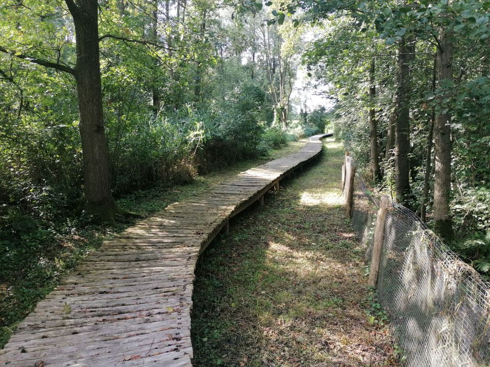
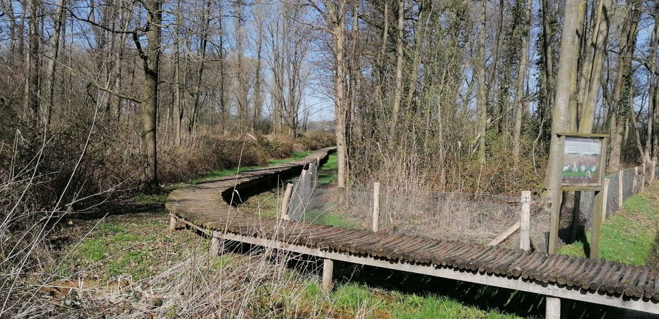
A walk on partly well-maintained paths and partly via (wet) grass through…
This signposted walking route starts at the De Vloeten car park along the road from Someren to Lierop. You can also start at Camping
Somerense Vennen on the Philipsbosweg. Follow the Vlerkenroute signs. The free brochure of this Vlerken walking route with a map and description of all objects is available at the Tourist Information Point, De Meer 21a Someren, or click the button below; "View route in PDF".
A walk on partly well-maintained paths and partly via (wet) grass through a very varied landscape with fields, meadows and wetland forests. During this walk we come across the name Vladeracke in the hamlet of Vlerken. The suffix 'acke' means settlement or residence. In the distant past, a few families settled here, creating the hamlet of Vlerken. Via the Slievenstraat, (Slieven comes from Slijven, Slie or Slij is mud, mud pool or mud) you walk towards De Oetert. The route also runs along the Kleine Aa, a branch of the Aa. In the stream valley of the Kleine Aa we find wet 'bare' grasslands with ascending alder pants. Alder breeches are forests in the wet stream valleys that are in principle under water every winter, often consisting of Alder and Willow trees.
Both have excellent resistance to prolonged wet feet. In the past, peat and iron pits were made in this area, the remains of which are still present. A lot of digging was done, especially in the nineteenth century. The water management in these areas changed radically with the construction of the Zuid-Willemsvaart (1820-1830) and during the canalization and normalization of the streams as part of the land consolidation works in the period 1955-1959. In the 50's and 60's the watercourses in almost the whole of the Netherlands were straightened through standardization. The sole purpose of this was to drain the water to the sea as quickly as possible. This is for the benefit of the accessibility of large agricultural machines in the fields.
The land parcels were reclassified as a result of land consolidation, because the landscape was literally being overhauled anyway as a result of the normalization of the streams. In both cases, only economic interests were considered and interests of nature, groundwater level, culture and landscape were completely ignored. Today, these interests are much more taken into account. There are even a number of initiatives and nature development projects to allow streams and waterways to meander again, i.e. to return them to their original meandering state.
Sights on this route
Starting point
Parkeerplaats De Vloeten
Lieropsedijk 72
5711PS Someren
Navigate to starting point
Attributes
You may also be interested in
-
Discover ‘t Gulden Land
Discover ‘t Gulden Land
Discover the place where greenery, water, cultural history and recreation go hand in hand.
(9.9 km) -
Through 't Gulden Land
Through 't Gulden Land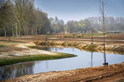
A tour of the head of the place where greenery, water, cultural history and recreation go hand in...
(7.3 km) -
Head of ‘t Gulden Land
Head of ‘t Gulden Land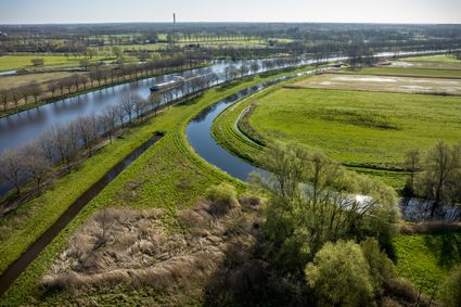
A short walk through the place where greenery, water, cultural history and recreation go hand in...
(2.7 km) -
The Laarbeek trail - Stage 5 (of 5)
The Laarbeek trail - Stage 5 (of 5)
The fifth stage (17 km) of the Laarbeekpad, a long multi-day hike across the territory of the mun...
(17.0 km) -
The Laarbeek trail - Stage 4 (of 5)
The Laarbeek trail - Stage 4 (of 5)
The fourth stage (15 km) of the Laarbeekpad, a long multi-day hike across the territory of the mu...
(13.0 km) -
The Laarbeek trail - Stage 3 (of 5)
The Laarbeek trail - Stage 3 (of 5)
The third stage (16 km) of the Laarbeekpad, a long multi-day hike across the territory of the mun...
(16.0 km) -
The Laarbeek trail - Stage 2 (of 5)
The Laarbeek trail - Stage 2 (of 5)
The second stage (13 km) of the Laarbeekpad, a long multi-day hike across the territory of the mu...
(13.0 km) -
The Laarbeek trail - Stage 1 (of 5)
The Laarbeek trail - Stage 1 (of 5)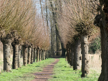
The first stage (15 km) of the Laarbeekpad, a long multi-day hike across the territory of the mun...
(15.0 km) -
Monastery walk Aarle-Rixtel
Monastery walk Aarle-Rixtel
This monastery tour lets you discover the beautiful nature around the Missionary Convent Holy Blo...
3 hour 20 minutes (13.0 km) -
Rand van De Peel
Rand van De Peel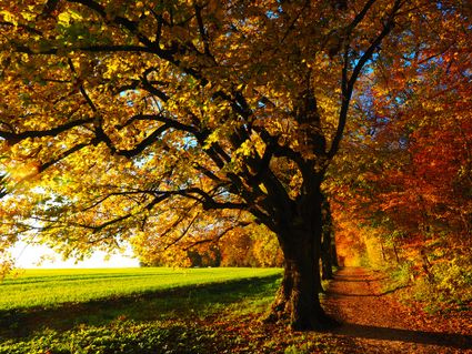
On the edge of the Peel, you can relax during this route. A varied landscape will continue to sti...
(26.1 km)