The Laarbeek trail - Stage 3 (of 5)
General information about the 5 stages of The Laarbeekpad
The Laarbeekpad is an approximately 75-kilometre multi-day hike across the territory of the municipality of Laarbeek Waterpoort van de Peel divided into five stages. The municipality is formed by four villages: Beek en Donk, Aarle-Rixtel, Lieshout and Mariahout. The multi-day hike goes through the centre of the municipality, on and along the outskirts. In stage two, the path goes a little way over the edge to avoid a loop in the Molenheide.
In the centre of the municipality, the trail follows brook the…
General information about the 5 stages of The Laarbeekpad
The Laarbeekpad is an approximately 75-kilometre multi-day hike across the territory of the municipality of Laarbeek Waterpoort van de Peel divided into five stages. The municipality is formed by four villages: Beek en Donk, Aarle-Rixtel, Lieshout and Mariahout. The multi-day hike goes through the centre of the municipality, on and along the outskirts. In stage two, the path goes a little way over the edge to avoid a loop in the Molenheide.
In the centre of the municipality, the trail follows brook the Goorloop several times and goes through the hamlet Het Laar, among other things this brook and hamlet Het Laar between the four villages has resulted in the name Laarbeek. The municipality, on the border of the Meierij and the Peel is what the term Waterpoort van de Peel already indicates a water-rich municipality with, within the municipality, the canals Zuid-Willemsvaart with a marina and the Wilhelmina Canal. Not only the canals but also brooks the Aa and the aforementioned Goorloop but also smaller streams such as the Schevelingse Loop, Heieindse Loop, the Ginderdoorse Loop and the Donkervoortse Loop flow through the municipality, furthermore water features and fens complete the term Waterpoort. So Laarbeek is a real water municipality. During the multi-day hike, one therefore passes bridges and small bridges several times. The term gateway to the Peel is derived from the fact that the municipality lies on the edge of the Peel.
The trail is divided into five stages with the starting and finishing points being the core of the towns with Beek en Donk being a twin village like Aarle-Rixtel with the difference that Beek en Donk has two cores, each with its own church building. A twin village is the designation of two villages originating close to each other with different names. The first stage starts in the core of Beek and the last the fifth stage starts on the Donk and then ends in the core of Beek. The core of Beek and the core of Donk are separated by a green strip containing a music garden. Since 2003, the new town hall of the municipality of Laarbeek, which was newly formed in 1997, has stood in this strip.
PLEASE NOTE:
A large part of this hike is unpaved!
This route is not suitable for wheelchairs or prams.
Courtesy of: klikprintenwandel.nl
Sights on this route
Starting point
Startpunt
Heuvel
5737 Lieshout
Navigate to starting point


End point
Eindpunt
Oranjeplein
5738 Mariahout
Navigate to endpoint
Directions
Reference is made to route posts at various points. The entries are intended only as additional landmarks.
1.
With the back to the kiosk and on the left across the road the former town hall, enter the narrow road ‘Kerkhofpad’ towards a cemetery to the right of house no.13, to the right of the narrow road is bust of ‘Martien Coppens’, follow the narrow road to the entrance of the cemetery.
Before the cemetery entrance RA, immediately afterwards LA, paved footpath with the cemetery on the left.
At the end of the footpath, at Y-junction LA, paved road, a little further RD, ignore road ‘Balduinstraat’ on the right, then past ‘Health Centre “Grotenhof” LA, ’Grotenhof", follow the road to a T-junction.
At this T-junction RA, ‘Kerkloop’, follow the road to a junction, ignore side roads, then at this junction LA, Albert Botslaan.
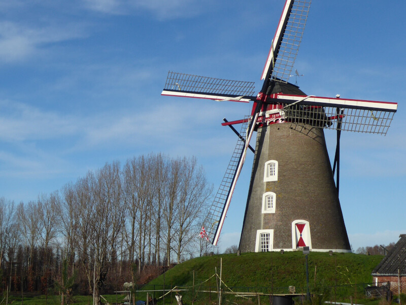
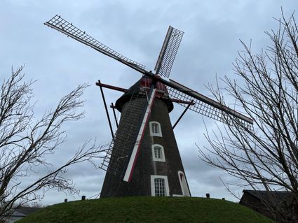
At the T-junction RA, then before a small park with mill De Leest on the left, follow the footpath along the road until a hardened footpath on the right immediately after the fence around the mill, ignore side roads.
# In 1899, a Mr Mannaarts ordered the construction of a mill. In 1907, the mill came into the possession of the De Leest family. The mill was restored in 1975-1976 so that grain could be ground again, from then on the still unnamed mill was named after the De Leest family of millers.
2.
At this footpath RA with the mill on your right, at the entrance to the mill, at 3-spot LA, then at the end of the footpath RA, follow the main road through the village.
Past house no.43 LA, a little further the road turns into a hardened footpath, at the end of the footpath, at T-junction RA, wide gravel path.
Before paved road LA, follow the paved footpath parallel to the road towards a bridge over the Wilhelminakanaal.
At the bridge LA cross the bridge towards ‘Gerwen’, across the bridge RA, follow the cycle path across the road to a junction with a through road, ignore side roads.
At this crossing RD cross the main road, watch out for busy road!!!, a little further at T-junction RA, ‘Bosrand’, the road bends further to the left, follow the road further until a T-junction at a wide unpaved path, ignore side roads and paths.
At this T-junction RA, ‘Roeklaan’, follow the wide unpaved path to a T-junction at a through road.
At this T-junction RA, follow the cycle path on the opposite side of the main road, watch out for busy road!!!!
3.
Past a fenced forest parcel with dwellings 2A and 2Z on the left, LA, unpaved cycle path with the fence on the left, past two scare fences the path bends to the right and at dwelling no.1 the unpaved path turns into a hardened road.
At 4 junction LA, wn route, near house no.8 the hardened road changes into a wide unpaved path.
Past the forest parcel on the right, at the crossroads RD, wn route, the wide path goes through the forest again after approx. 130m, follow the path with further on kn43 volg 42 until a path on the right hand past the forest parcel on the right, ignore other side paths.
At this path RA, wn route, path with bench and BL sign ‘Ruweeuwsels’ and a little further a wooden barrier.
After approx. 220m RA, kn42 follow 9, path through the forest edge with a plot of grassland on the left.
At 3 junction between three imposing beech trees keep left, wn route.
At T-junction RA, wn route, then after approx. 60m LA, wn route, further on past a wooden barrier the path widens.
4.
At end of path, at Y-junction keep right, hardened cycle path, wn route, a little further LA across bridge, kn9 follow 29, on the other side at 5-junction follow road ‘Sluisweg’ with slight bend to left, kn29 follow 11.
Follow the road with a bend to the right, ignore the road ‘Sluisweg 3-4-4a’ on the left, the wn route is abandoned.
At T-junction LA, through road, immediately afterwards RA, unpaved path with a metal barrier and sign ‘Welkom in waterwingebied Lieshout’.
Past a metal barrier, at T-junction RA, path with a forest plot on the right.
At T-junction LA, follow the wide unpaved path to a junction with a paved road, ignore side roads.
At this crossing RD, ‘Schutsstraat’, further on the wide path turns into a hardened road.
5.
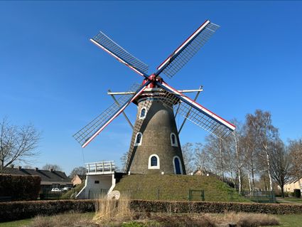
Continue to follow the road with a bend to the right, ignore dead-end path on left, continue to follow the road to a junction with a cycle path towards mill Vogelenzang on left, slightly past house no.34 left of the road.
At this crossing LA, ‘Molendreef’, cycle path towards mill Vogelenzang, wn route.
# Mill Vogelenzang was built in 1816 to replace a toppled standerd mill. The mill contains quite a few parts of that predecessor. The stones of the mill hull were fired on site the loam for it was extracted from a fen behind the mill.
Past the mill and to the right a narrow unpaved footpath LA, ‘Citadelsteeg’, kn26 follow 25, wide unpaved path.
In a slight bend to the left of the path RA, kn25 follow 98.
Immediately after a stream LA, grass/maintenance path with the stream on the left and a little further willows on the right, the wn route is abandoned.
Past a weir, at crossing RA, unpaved path, kn24 follow 97.
#Further on the trail goes along a narrow path on a hill, which formerly served as a rubbish tip. Especially later in spring and summer, the path can be difficult to walk on due to overgrowth. As an alternative: at crossroads LA, follow the paved road to a junction. At this junction RD, ‘Broeksteeg 2-4-7’, follow the road to a T-junction. Continue point 6 4th line At this T-junction RA.........
At junction with paved road RD, unpaved path with metal barrier and sign ‘Open’, wn route.
6.
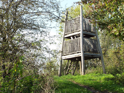
For information panel ‘Pionieren door de eeuwen heen’ LA enter the rising path with a watchtower on the hill, the wn route is left, pay attention when climbing the watchtower, limited height to the plateaus and the large distance between the steps, past the watchtower continue to follow the narrow path over the hill until a T-junction at a hardened road.
At this T-junction LA, paved road.
At crossroads RA, ‘Broeksteeg 2-4-7’, follow the road to a T-junction.
At this T-junction RA, wide unpaved path.
After approx. 70m LA, grass/maintenance path with a watercourse on the left, wn route.
At a row of trees on the right RA, unpaved path with a bench, wn route.
At crossroads RD, ‘Stekkermortel’, paved road, kn21 follow 81.
Near house nr.6 LA, wide gravel path, wn route.
7.
Before the forest edge on the right RA, kn81 follow 20, follow the path with a wooden barrier and with the forest edge on the left to a forest path with stiles and a picnic table on the left near a large round “silo” with a pointed roof on the right, ignore other side paths.
At this path LA, the wn route is abandoned, follow the path to the concrete well PP022 on the right, ignore ATB paths.
Turn right at this well, ignore the path on the left.
Past a row of posts, at the T-junction RA, follow the path with a clearing on the left until you reach a path on the right along the forest edge.
At this path RD, ignore the path along the forest edge on the right, wn route.
RD, ignore the path on the right, kn20 follow 80, further on the path bends to the left.
In the 2nd bend to the left of the path, immediately after a bench RA, the wn route is abandoned, follow the narrow path with a sign ‘Opengesteld’ through a forest parcel to a T-junction in front of a fenced area (MOB complex), ignore side path on the left.
At this T-junction RA, path with the fence on the left.
At the crossroads with a paved road and a gate on your left, go RD, then continue to a T-junction before a fence just beyond the fenced area.
At this T-junction RA, path with a fence on the left and a little further a metal barrier, then at 4-junction with a hardened road on the right LA, path with the forest edge on the left.
8.
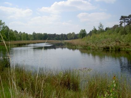
After approx. 150m LA through a folding gate, narrow path with sign ‘Open’, then slightly before the oblong fen Torreven RA, narrow path through the heath with the fen on the left.
After approx. 250m, just before a bench and an information panel RA through a gate, past the gate, at the crossroads RD, unpaved path.
At T-junction LA, hardened road.
After approx. 125m, past a farm with stables on the right RA, unpaved path.
At 4-junction LA, paved road, ‘Knapersven’.
Continue to follow the road with a slight bend to the left, ‘Knapersven’, kn91 follow 90, ignore the road on the right, continue to follow the road to a T-junction in the village in front of a procession park, ignore side roads.
# If the gate of the procession park is open you can also walk through the park, in the park keep to the left until a gate, the end point is on the opposite side of the road after leaving the park.
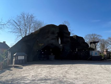
At this T-junction RA, kn90 follow 93, a little further the road bends to the left with the Lourdes Cave on the left.
# The Lourdes Grotto near the church was a faithful copy of the Grotto of Massabielle as it was at Lourdes in 1935. In 1982 a part collapsed and in 1996 the rest. In 1998, with the help of volunteers, repairs began after which the renewed grotto was inaugurated in 1999.
At junction LA, follow the road to the square on the right, the end point.
Legend:
RA = turn right, RD = straight on and LA = turn left
BL = Brabants Landschap
Walking networks:
Green/yellow markings, kn stands for a junction post with numbered direction, wn stands for a network route post with direction only.
You may also be interested in
-
Head of ‘t Gulden Land
Head of ‘t Gulden Land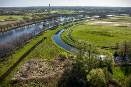
A short walk through the place where greenery, water, cultural history and recreation go hand in...
(2.7 km) -
Discover ‘t Gulden Land
Discover ‘t Gulden Land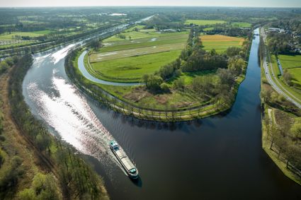
Discover the place where greenery, water, cultural history and recreation go hand in hand.
(9.9 km) -
Through 't Gulden Land
Through 't Gulden Land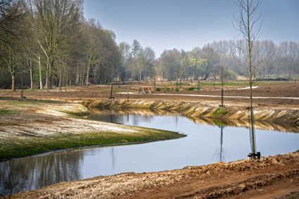
A tour of the head of the place where greenery, water, cultural history and recreation go hand in...
(7.3 km) -
The Laarbeek trail - Stage 2 (of 5)
The Laarbeek trail - Stage 2 (of 5)
The second stage (13 km) of the Laarbeekpad, a long multi-day hike across the territory of the mu...
(13.0 km) -
The Laarbeek trail - Stage 4 (of 5)
The Laarbeek trail - Stage 4 (of 5)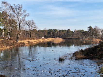
The fourth stage (15 km) of the Laarbeekpad, a long multi-day hike across the territory of the mu...
(13.0 km) -
The Laarbeek trail - Stage 5 (of 5)
The Laarbeek trail - Stage 5 (of 5)
The fifth stage (17 km) of the Laarbeekpad, a long multi-day hike across the territory of the mun...
(17.0 km) -
The Laarbeek trail - Stage 1 (of 5)
The Laarbeek trail - Stage 1 (of 5)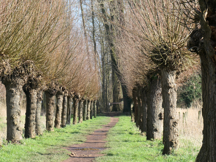
The first stage (15 km) of the Laarbeekpad, a long multi-day hike across the territory of the mun...
(15.0 km) -
Monastery walk Aarle-Rixtel
Monastery walk Aarle-Rixtel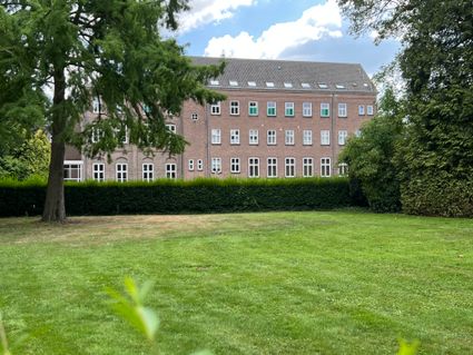
This monastery tour lets you discover the beautiful nature around the Missionary Convent Holy Blo...
3 hour 20 minutes (13.0 km) -
Rand van De Peel
Rand van De Peel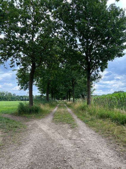
On the edge of the Peel, you can relax during this route. A varied landscape will continue to sti...
(26.1 km) -
Recht en Orde Laarbeek
Recht en Orde Laarbeek
Cultural-historical walking route between jaw and gallows.
(19.0 km)