Art and culture in the Peel
Visit the lush remains of Asten Castle, follow a culture route through Helmond or a chateau domain walk in Deurne. You discover the most beautiful heritage. The Peel also has a diverse range of museums. Step back in time to a peeldorp from 1900 in Gemert, admire the Wieger museum and the nearby Toon Kortoomspark and don't miss the celebrated Museum Klok & Peel.
73 to 96 of 141 results
-
School Katholieke Lagere Meisjesschool | Bakel
School Katholieke Lagere Meisjesschool | Bakel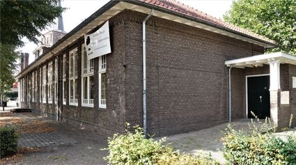
This girls' school belonged to a convent of the Sisters of Oirschot.
Bakel -
Keske Kruiseind | Gemert
Keske Kruiseind | Gemert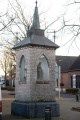
The keske on the Cross End has four niches and was built in this form in 1911, but has predecessors.
Gemert -
Boerderij: Espse Hoeve, Bakel
Boerderij: Espse Hoeve, Bakel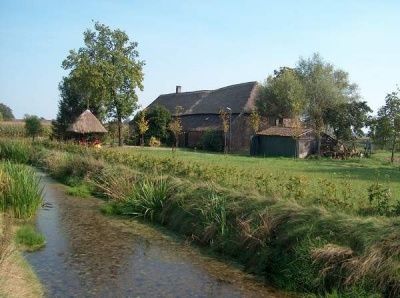
This moat farm was built in the 15th century and was owned by the Gemert Commandery of the Teuton...
Bakel -
Boerderij: Gertrudahoeve, De Rips
Boerderij: Gertrudahoeve, De Rips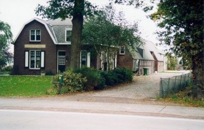
This national monument is a typical reclaimed farmhouse, a melting pot of all kinds of styles and...
De Rips -
De voormalige hoeve Hazeldonk
De voormalige hoeve Hazeldonk
The Hazeldonk is a vanished medieval farmstead surrounded by a moat.
Gemert -
Virmuntse Hoeve
Virmuntse Hoeve
Former farmhouse, owned for centuries by the Teutonic Order and the Chapel of Handel.
Handel -
Boerderij: De Sijp, Elsendorp
Boerderij: De Sijp, Elsendorp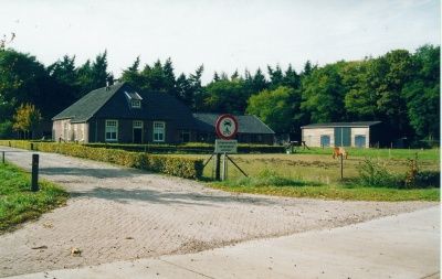
From this house, the reclamation of the De Sijp estate was regulated. Indeed, this estate was par...
Elsendorp -
Grenspaal Paal achter 't Zand | De Mortel
Grenspaal Paal achter 't Zand | De Mortel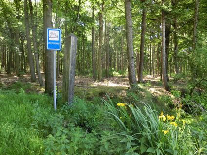
Boundary post between Bakel and Gemert. The name comes from the drifting dunes that used to lie h...
De Mortel -
WWII: Lancaster en Burg. Wijtvliet monument | De Rips
WWII: Lancaster en Burg. Wijtvliet monument | De Rips
This memorial provides information about the crash of a Lancaster plane that killed 7 people. It...
De Rips -
Wit-gele-kruis
Wit-gele-kruis
This building housed the Witgelegele Kruis, founded in Brabant. A health care society where nuns...
De Rips -
Boerderij: Oude langgevel, Bakel
Boerderij: Oude langgevel, Bakel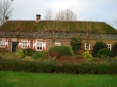
The farm from the late 19th century aptly shows the developments in agriculture in recent centuries.
Bakel -
Helling in de Haveltweg | Handel
Helling in de Haveltweg | Handel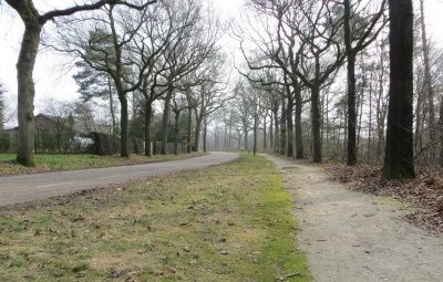
If you look from west to east across the Haveltweg you will see a slope in the road. The differen...
Handel -
Molen De Beer | Gemert
Molen De Beer | Gemert
Where the Eendracht now stands, mill De Beer was built in the Middle Ages.
Gemert -
Boswachterswoning De Rips
Boswachterswoning De Rips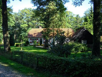
From 1900, the Foresters' House was used as such.
De Rips -
Grenspaal Middelpaal
Grenspaal Middelpaal
Boundary post between Gemert and Bakel with the oldest mention in 1669 and which from 1818 was ca...
Elsendorp -
Kapel Ossenkapel | Handel
Kapel Ossenkapel | Handel
This chapel was built on the site of the Marian miracle of Handel. Handel is the oldest Marian pi...
Handel -
Huijs Bloemendael | Handel
Huijs Bloemendael | Handel
This is the original house of the penitent brothers in Handel. These religious were expelled duri...
Handel -
Keskesdijk | Handel
Keskesdijk | Handel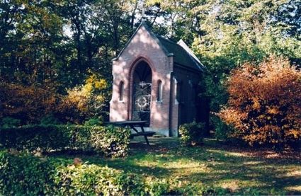
Pilgrimage route en route to the medieval Marian pilgrimage site of Handel. There are seven keske...
Handel -
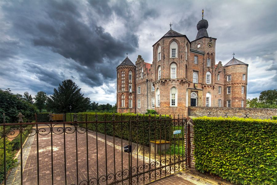
Kloosterkasteel Gemert
Kloosterkasteel Gemert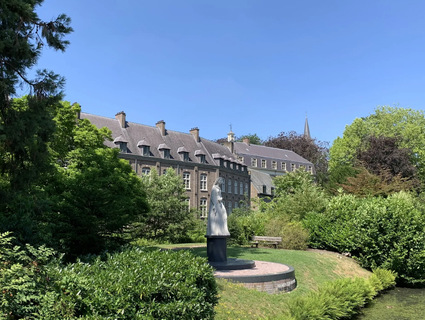
Nobleman Rutger van Gemert (ca. 1150 - ca. 1220) became a knight of the Teutonic Order during his...
Gemert -
Boerderij: De Dompthoeve, Elsendorp
Boerderij: De Dompthoeve, Elsendorp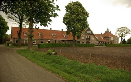
In the large-scale peel reclamations, all kinds of experiments were carried out. The Dompthoeve w...
Elsendorp -
De voormalige hoeve Handel
De voormalige hoeve Handel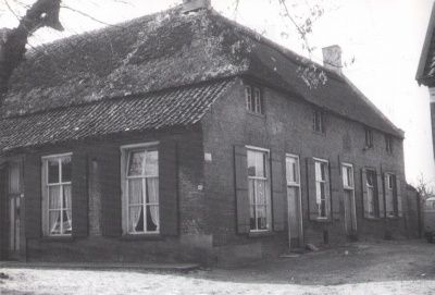
The vanished Handel farmstead is the oldest clearing, from which the village of Handel emerged.
Handel -
De Pionier
De Pionier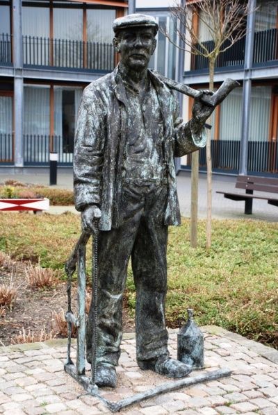
The Pioneer as a statue was unveiled in 1994 as a thank you from Rabobank and a tribute to forest...
De Rips -
Processiepark | Handel
Processiepark | Handel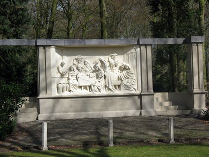
This beautiful Procession Park is a National Monument belonging to the centuries-old Marian worsh...
Handel -
Kapel Sint Antonius | Gemert
Kapel Sint Antonius | Gemert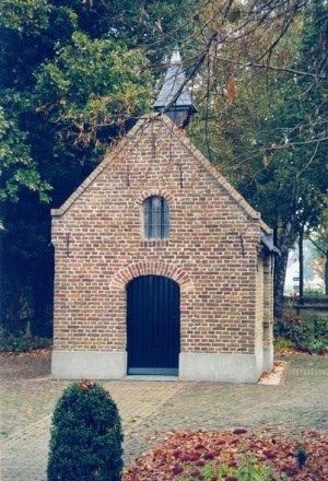
This field chapel of the Guild of St. Anthony and Sebastian dates back to 1564 and is still part...
Gemert