Walking route network Asten Overview map
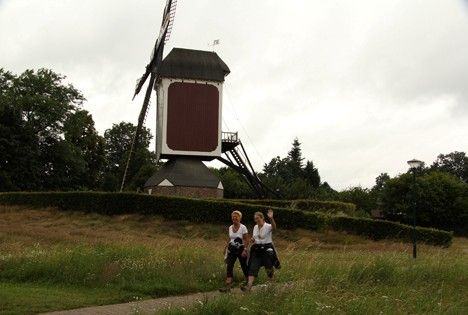
The yellow symbols with numbers on the map correspond to the yellow-green nodes in the field. By walking from one node to the next, you create your own walking route. At each node you can choose in which direction you wish to continue the walking route.
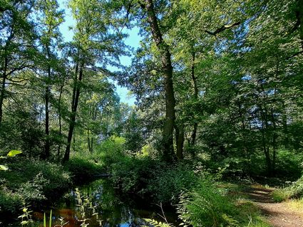
The walking route network can be walked in two directions. On the map you will see a number between the nodes that indicates the distance between the nodes. This way you can precisely calculate the length of the route.
On the map you will find three different types of walking…
The yellow symbols with numbers on the map correspond to the yellow-green nodes in the field. By walking from one node to the next, you create your own walking route. At each node you can choose in which direction you wish to continue the walking route.
The walking route network can be walked in two directions. On the map you will see a number between the nodes that indicates the distance between the nodes. This way you can precisely calculate the length of the route.
On the map you will find three different types of walking paths: unpaved, paved and boots path. Depending on the season, footwear or condition, it is possible to avoid difficult paths. The paved paths are best suited for a walk with wheelchairs or prams. The boot path is especially soggy after prolonged rainfall. High walking shoes or boots should not be missing during this period.
Places of interest are indicated with symbols on the map. The overview map of the Asten walking route network is available at VVV Asten for the price of € 5.95.
Overview maps of other places in the Peel are also available at VVV Asten, such as Deurne, Gemert-Bakel, Helmond, Laarbeek, Someren, Geldrop-Mierlo, etc. etc.
You may also be interested in
-
Walking route Museum & Castle
Walking route Museum & Castle
Signposted walking route of 15 km along Museum & Castle.
(15.0 km) -
Walking route Beijaard Peijke
Walking route Beijaard Peijke
A short walk from Museum Klok en Peel
(1.9 km) -
Walking route The Ommels Ommetje
Walking route The Ommels Ommetje
This Ommetje is a short walk through the center of Ommel. The distance is only 2.5 kilometers. Yo...
(2.5 km) -
In de ban van de Aa en de Gulden Aa
In de ban van de Aa en de Gulden Aa
Picturesque hiking route through the Aa basin.
(6.3 km) -
Hiking the Witvenroute in Someren
Hiking the Witvenroute in Someren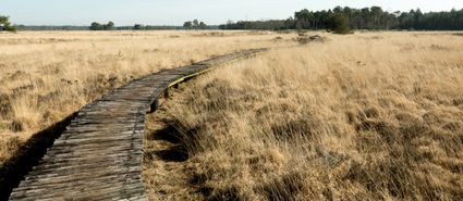
The route starts at the Keelven parking lot along the Provincialeweg Someren-Heeze. From the star...
(6.0 km) -
Jeneverbesroute
Jeneverbesroute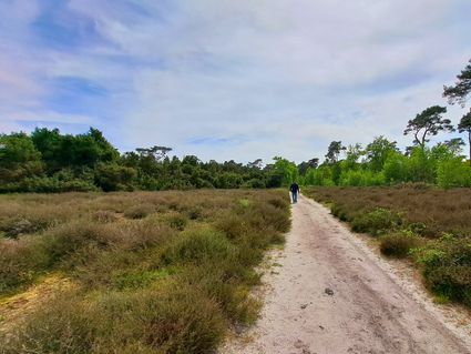
With the theme route Juniper Route you will discover the secrets of the Vlierdende forests near D...
(8.1 km) -
Walsberg forest route
Walsberg forest route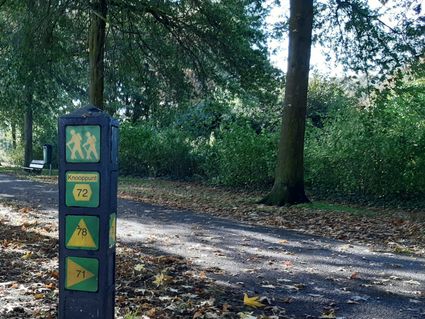
Nice walking tour through the Walsberg forest on the walkingnetwork
(5.5 km) -
Walk in the countryside near the Aarle-Rixtel Mission Centre
Walk in the countryside near the Aarle-Rixtel Mission Centre
This is one of the walking routes that start at the Heilig Bloed Missionary Convent on Kloosterdr...
(8.8 km) -
Pleasant walking tour through the history of Liessel
Pleasant walking tour through the history of Liessel
This walking tour lets history relive. The tour leads along special places where monuments have b...
(5.0 km)
Sights on this route
Starting point:
Overzichtskaart wandelroutenetwerk AstenBurg Wijnenstraat 1
5721 AG Asten
Navigate to starting point
Starting point
Overzichtskaart wandelroutenetwerk Asten
Burg Wijnenstraat 1
5721 AG Asten
Navigate to starting point
End point:
Overzichtskaart wandelroutenetwerk AstenBurg Wijnenstraat 1
5721 AG Asten
Navigate to endpoint